Birds Eye Streetview

They beat me to it!  Mapchannels created this very neat customizable mashup of Google Street View with Microsoft Bird’s Eye, with all the elements I was muttering about, to myself.  As a matter of fact, Mapchannels has several other nice tools which you can customize and put on your website.  So who are they?  Apparently, a very low profile organization, no name or location to be discovered, a mystery.   So in case you read this, Mapchannels, THANK YOU!

Update 30/6/2018: Amazingly, it still works!  New and Improved (Dam Square). Or try I Giardini in Venice! Explanation and Instructions from Mapchannels

Dutch Street View

Google Street View arrived in the Netherlands last month, along with a creative application for Street View “sightings”, those funny and weird things caught by the Google car’s 360 camera.  If you don’t want to spend all your time coming the streets for something hilarious, you can take a look at what other people have found at “Streetview Nederland”.  So far just Amsterdam, Rotterdam and Groningen.  Note: anything too salacious or incriminating seems to be quickly removed, and if you want your house “blurred”, Google will do that.

Update 30/6/2018: Dutch version not available, but other sites developed… such as this – Streetview World . Better yet, google “Streetview sightings“.

Traveling Salesman Revisited

traveling_salesmanNew SweetMaps application:  the Traveling Salesman’s European Vacation.   I take no credit for the original idea or clever coding of a traveling salesman program for Google Maps developed by Geir Kokkvoll Engdahl.  (See my original  post last month.  However, while writing a research paper for a UNGIS course at the Vrij University, the idea of a sweet little application dawned on me.  This is just a start… no doubt someone else could take this further.  There are limitations, and it will be interesting to see if anyone uses it and whether my Google Maps API account will be overloaded.   I would happily take comments, suggestions, bug reports.

Update 17/6/2018: Amazingly this little PHP app still works (sort of). Try just two or three cities. The reset doesn’t seem to work, so reload the page to start over. Anyway, it was the thought that counted!

The Vacationeers

vacationeersIrresistable. View it on YouTube. But watch your back.

The Travelling Salesman Problem

optimap_TSP_solver
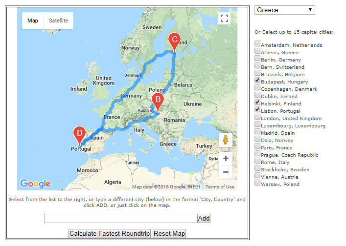
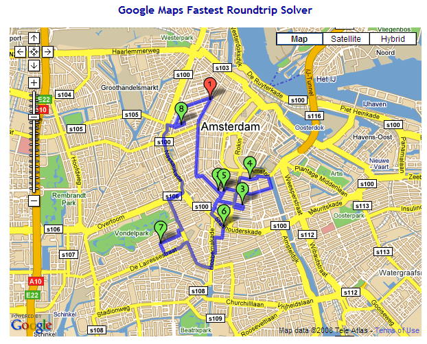
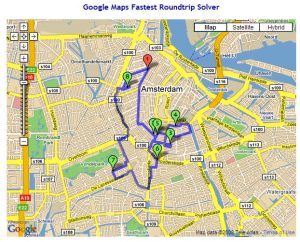
Geir Kokkvoll Engdahl, a Norwegian guy born in ‘83, posted a Google Maps API  implementation of the classic Traveling Salesman Problem (TSP) called “Optimap” on his blog last July, and has since added the ability to enter multiple destinations with lat/long codes, and also the javascript source code (no longer valid link) so we can examine and play with it.   The application, of course, relies on Google’s routing engine (driving directions) to calculate distances between any two points, and it is not certain that this is always the shortest distance.  There is a bit of discussion about this on the Google Maps API Group (search on “optimal route”).  Engdahl’s program uses brute force up to 10 points, and ant colony heuristics from 11-20 points.  With Google’s restrictions on daily driving-direction requests (10,000) the maximum number of points is limited to 20… so this website won’t soon become the UPS routing-tool-of-choice, but may be useful for you travelling googlemen and women.

Update: Engdahl updated Optimap in 2012. See his blogpost.

Update Google Pricing June 2018: So much has happened to Google Maps for developers, but regarding the 10,000 hits limit, that has all changed to another pricing model.
The very latest is found here: https://cloud.google.com/maps-platform/user-guide/pricing-changes/
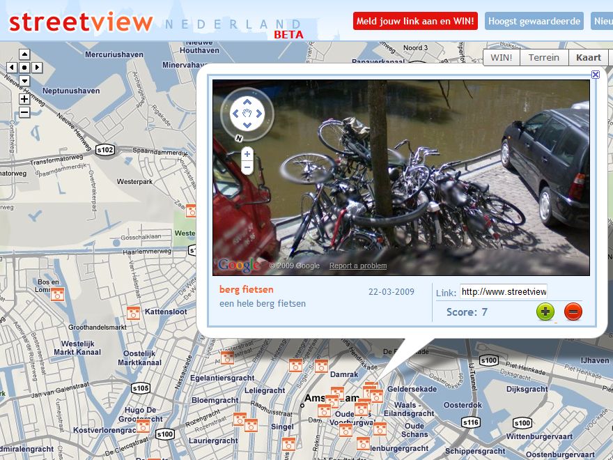
Skiing Anyone?

google_terraine_french_alpsYou can’t take your eyes off them for a second.  Terrain view in Google maps adds a new dimension.  It is not as powerful as its counterpart in Google Earth, where elevations can also be measured and displayed.  Not yet.  But more is clearly on the way.  Last week they also launched collaboration “MyMaps“, which is bound to spearhead a huge new category of online map applications.  And finally, another major announcement, push-button import of KML, KMZ and RSS files into MyMaps.  This was possible with a little programming (using the API) before, but now everyone can do it!  (Well, sort of.)

Update 2018: Current technique for getting terrain maps.

So. California Fires Mapped

san_diego_google_mapHuge fires are raging in California, fanned by strong winds yesterday.  Looking for maps online… and there’s not too much available if you wanted to know which way to run.  Of course, you’re probably not sitting at your computer, but more likely talking to the competent guy with the orange hard hat who is patrolling the neighborhood and has up to the minute routing information.  Disaster response is still a tricky application for GIS.  Getting the correct information is the hard part.  All those California GIS guys are ready to go, but probably waiting for a phone call or a shape file.

so_cal_fires_oct_22The helpful Google fire map above was created by KPBS Online, Sandiego TV/Radio station, presumably including information from listeners calling in.  (Interesting how the fire stops conveniently at the Mexican border.)   The static map (right) was made with ESRI software by the OES (Office of Emergency Services), displayed on their website.  Interesting, and shocking, but not very helpful to the locals.

How Google Maps

google_earth_x600There’s a nice article in Technology Review, How Google Maps the World, with a simple explanation of the process from satellite to website.  Makes it sound so easy.  By the way, the company producing most of the high resolution satellite images is DigitalGlobe, and if you want to buy just one of the little snapshots, say a shot of the Dam Square  as an 8 x 10 print, it will cost you $19.95, so I guess we can be happy Google is footing the bill for the earth.  (Thank you Richard.)

Update 16/6/2018 – new website for DigitalGlobe, more features, ask for quote.
DigitalGlobe is a cool Satelite company providing imagery for just about everyone. Their next satelite series to be launched in 2020/21 is described in Wikipedia:
“WorldView-Legion: Currently being built by SSL, WorldView-Legion is DigitalGlobe’s next generation of earth observation satellites. WorldView-Legion consists of six satellites planned to launch in the 2020/2021 time frame into a mix of sun-synchronous and mid-latitude orbits.[31] These satellites will replace imaging capability currently provided by DigitalGlobe’s WorldView-1, WorldView-2 and GeoEye-1 Earth observation satellites. WorldView-Legion is contracted to launch on a two flight proven SpaceX Falcon 9 missions.”

NYC Subway Map (Under the Radar)

brooklynStumbled on this one today, which could be useful to friends and family, the NYC Transit Map.  This unassuming programmer Greg Brail has a day job and doesn’t seem to want to be bought by Google or anyone else.  The applet has been on the Internet since 1996.  About 1000 people use this per day, but this tripled on Sept 11, 2001.

28-05-2018 update: The link above no longer works. Google themselves incorporated public transportation onto their maps in June 2012, releasing transit directions for 475 regions around the world. (Not sure when exactly NYC subways were included.)

See the blog for developments in the Google Maps Platform since 2008.

The world of myMaps at Ongopongo

ongopongoYou might have thought nobody was doing this myMaps thing, until you look on Ongopongo, and they’re everywhere, they’re everywhere!  It is now so easy to make your own collections of map information about absolutely anything or nothing.  Today I discovered a noodle bar in my neighborhood highly recommended by a young English woman, but alas the noodles were overly salty and the cashews were old.  So I removed her map from my mashup collection, making it a “nongopongo”.

Update 31/5/2018:  Only home page Ongopongo seems to work now.  Google maps still does not have a good way to find, for example, all publicly shared “MyMaps” in Amsterdam, or all the maps about noodle bars, etc.  No catalogue ability.