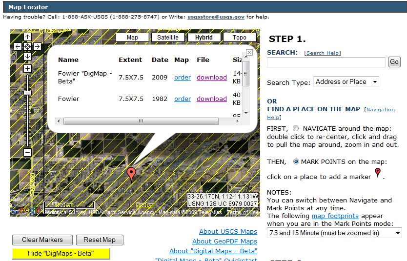
 The USGS which calls itself “the nation’s largest water, earth, and biological science and civilian mapping agency” yesterday announced the availability of free vectorized topographic maps for the US in GeoPDF format. Details are on their Digital Map home page. Raster images of topographic maps have been available in GeoPDF form for some time, but the new series will include vector “layers” which can be switched on and off – contours, water, transportation, labels, etc. … just like a real GIS, but much easier to share. So far, only Arizona is available from the USGS, but much more will be released this year.
The GeoPDF reading software (TerraGo Desktop) can be download free from the developer, TerraGo Technologies. It is essentially a toolbar which is added to Adobe Reader which makes it possible to see the layers, to do a few spatial calculations (distance and area), and with a single click, hop into Google Maps. This is a fascinating development for the GIS world. Late last year ESRI announced an extension for ArcGIS 9.3 for exporting to GeoPDF. The US government is embracing GeoPDF in a big way, so little TerraGo will probably go a long way. After three venture-capital financing rounds will they go public, or be gulped by Google? Could we be looking at the ultimate Google/GIS Mashup? More later.
Update 30/6/2018: TerraGo has expanded and developed new products and remains independent. Interesting: TerraGo Magic
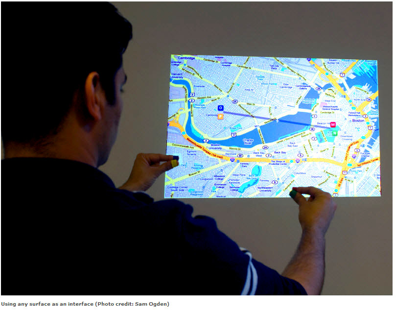 Sixth Sense is a multi-component wearable multi-function device invented by Pranav Mistry, a researcher at MIT’s Fluid Interfaces Group. It was demonstrated at the TED conference in February this year by Belgian Patty Maes, leader of the MIT lab, and this fabulous video describes the various features, and potential applications. Since one of the demonstrated applications is a map interface, I’m including it here, but the coolest thing (to me), is a watch created by drawing a circle on your wrist. As I perpetually lose watches, this would be the perfect solution.