Nautical Overlay
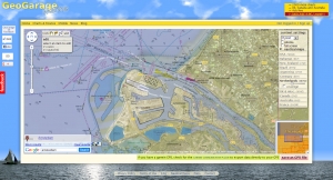
 This website from GeoGarage layers nautical maps geo-rectified to fit Google’s brand of Mercator. The slider control allows you to adjust the transparency. First you must acknowledge that you can’t trust these maps for actual navigation! They are designed for planning and analyzing. Nice little routing tool allows you to plot a course including distances, and export to a Garmin GPS devise. Seems like huge potential here.

