So. California Fires Mapped
 Huge fires are raging in California, fanned by strong winds yesterday. Looking for maps online… and there’s not too much available if you wanted to know which way to run. Of course, you’re probably not sitting at your computer, but more likely talking to the competent guy with the orange hard hat who is patrolling the neighborhood and has up to the minute routing information. Disaster response is still a tricky application for GIS. Getting the correct information is the hard part. All those California GIS guys are ready to go, but probably waiting for a phone call or a shape file.
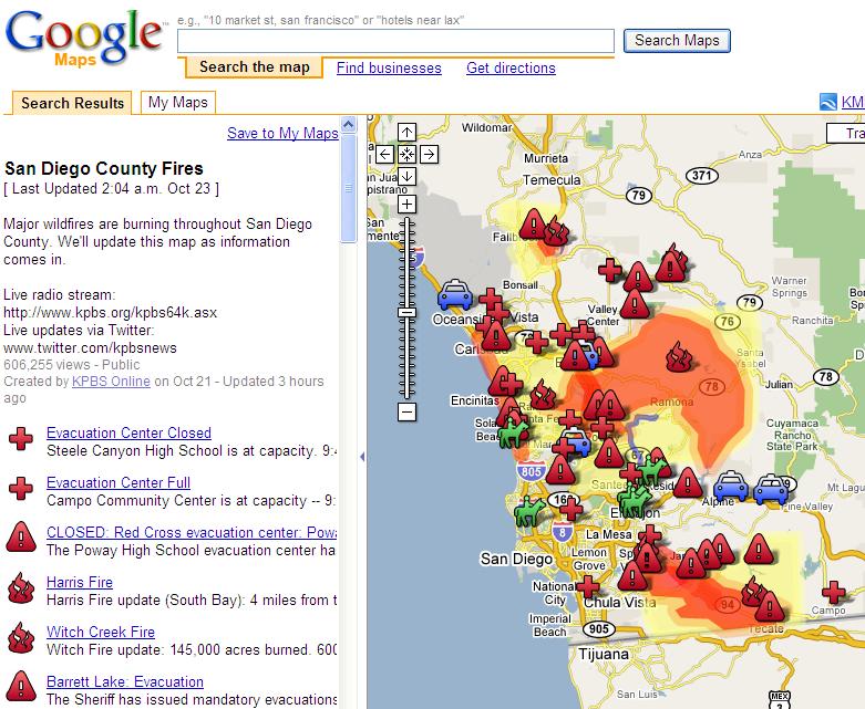
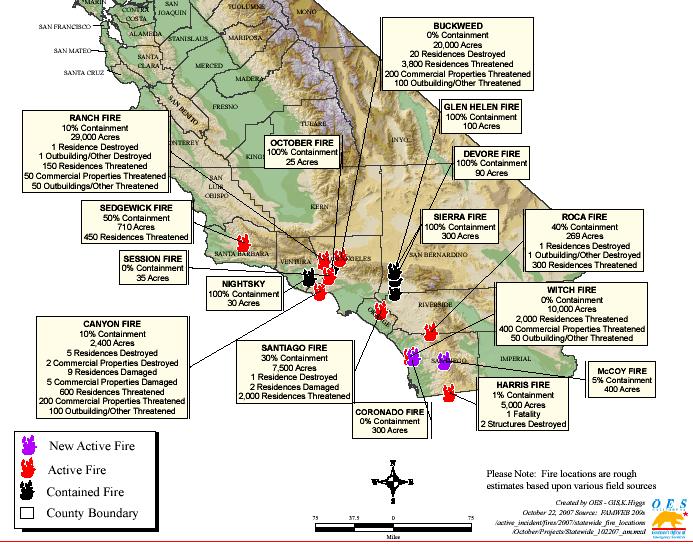 The helpful Google fire map above was created by KPBS Online, Sandiego TV/Radio station, presumably including information from listeners calling in. (Interesting how the fire stops conveniently at the Mexican border.) The static map (right) was made with ESRI software by the OES (Office of Emergency Services), displayed on their website. Interesting, and shocking, but not very helpful to the locals.