TeleGeography Tells a Story
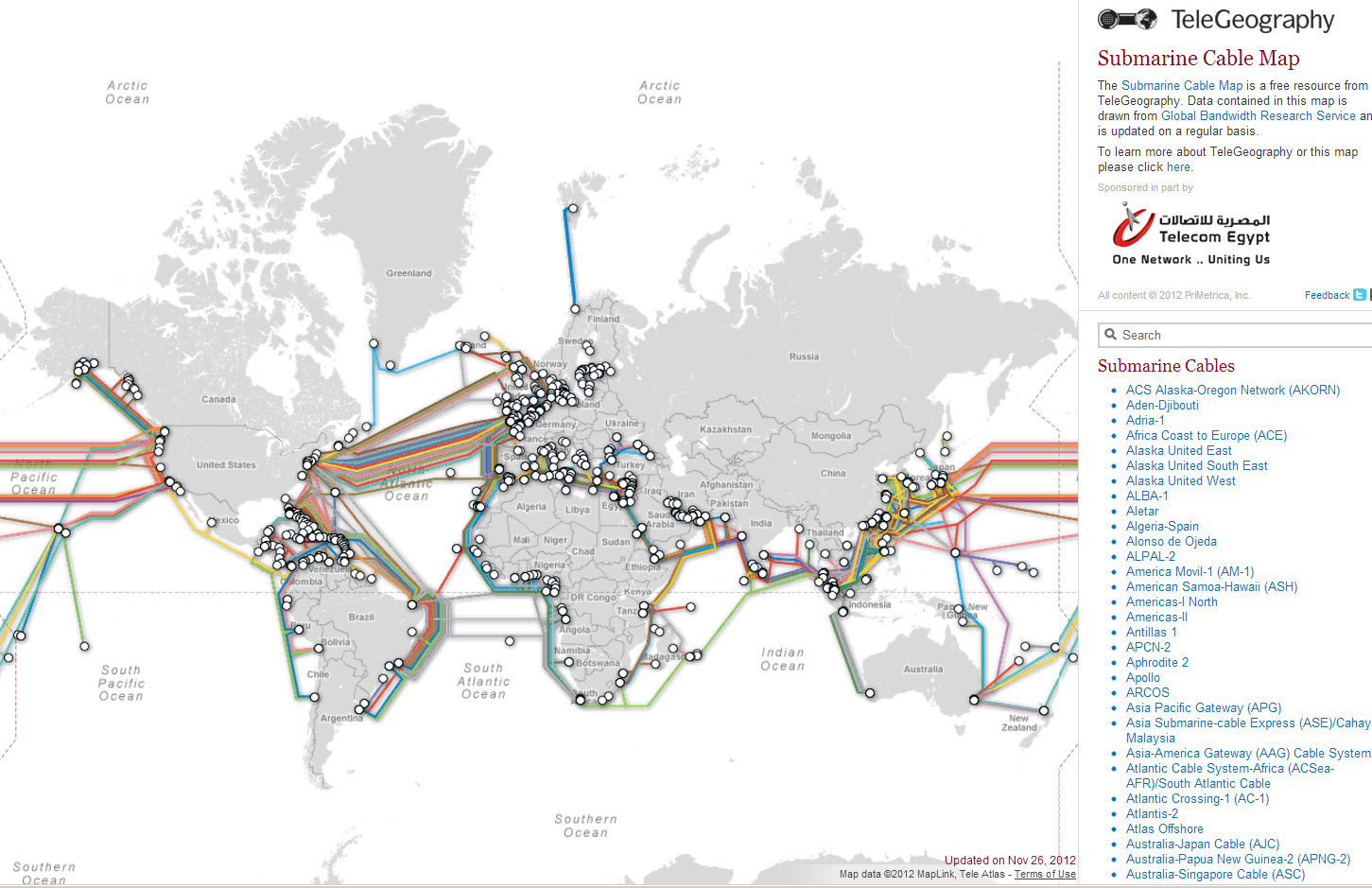 An interactive map of Submarine cables by Telegeography lets you explore the huge underwater infrastructure of communication cables. The first transatlantic cable laid in in 1858, and the rest is Wikipedia history. We tend to think ofsatellites and wireless communication as being dominant, but actually 99% of global Internet traffic depends on submarine cables. Telegeography made this maps by drawing routes and points with Adobe Illustrator, importing into Avenza’s MapPublisher, exporting to KML, creating Google Fusion tables, and publishing using the GoogleMaps API. (Here is their helpful explanation.)
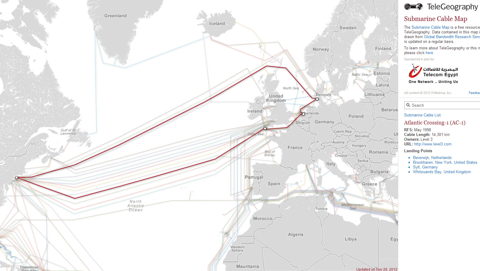
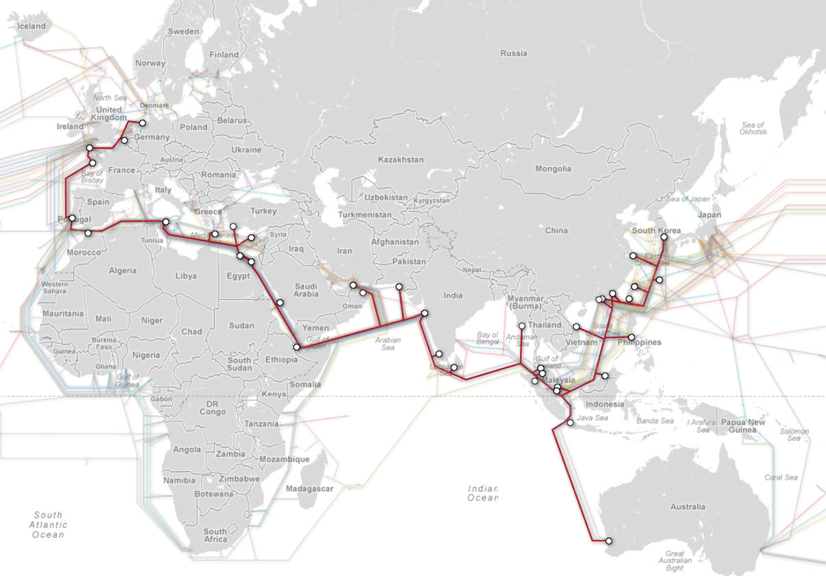
Interactivity allows you to select and isolate cities, or cable systems to get more details. For example, this images shows the Atlantic Crossingcable which connects Beverwijk and Brooklyn. And this is the famous (and longest at 39,000 kms) system, the SeaMeWe system.