Onion on Apple
 The Onion, as always, brilliant.…
The Onion, as always, brilliant.…
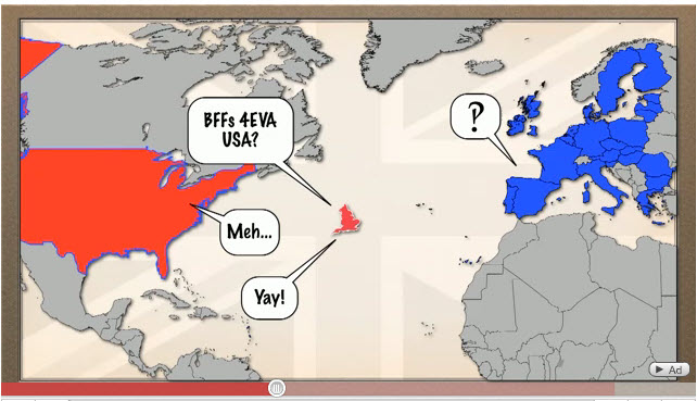 This is a great little animation: “The Difference between the United Kingdom, Great Britain, and England Explained“… plus a lot more explaining about the old British Empire, and “the Crown”. The guy (C.G.P.Grey) sure talks fast, but thank goodness you can replay it if you are motivated! This is the kind of information you sometimes wonder about but never get around to looking up. His source is Wikipedia, so hope they’ve got it right! Found this video via NACIS (North American Cartographic Society). In case you can’t take the monologue, he published the script on his blog.
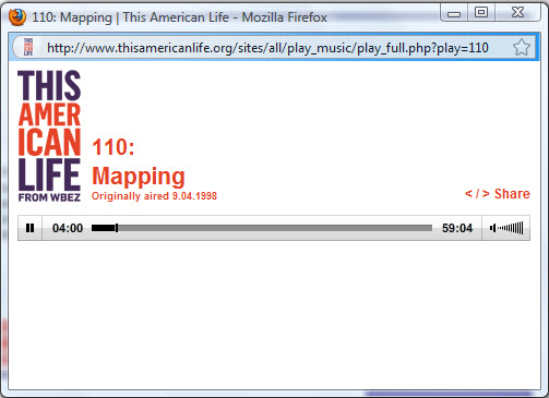 This episode of This American Life is almost 13 years old, long before “MyMaps”. The theme of the episode is “Mapping” and there are five parts, one for each of the five senses. Part one, Sight, is an interview with Denis Wood a thought-provoking discussion about why maps are only meaningful because they do NOT show everything. Being “selective” is the key to making a any map. This is the only segment which is directly related to maps in the SweetMaps context. But the rest is pure fun:
Hearing — the sound of ordinary home and office background noises and how they can drive you nuts. Smell — an attempt to understand (or map) the functioning of the Nose, and to construct a commercially-available electronic nose, including a replacement for canine drug-sniffers. Touch — a woman obsessively maps her body, fearing cancer. Taste — one man’s description of tastes on in the neighborhood of Pico Boulevard in LA. Classic Ira Glass.
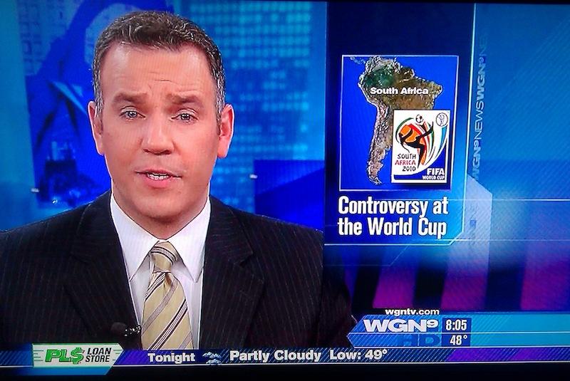 This priceless image from WGN News in Chicago on June 16 was noted by the Huffington Post Comedy. It is being circulated (outside the US) with the title “No wonder they can’t find Bin Laden.” Ouch.
Update 3/9/2018: The Huffington Post link is gone, but the picture says it all.
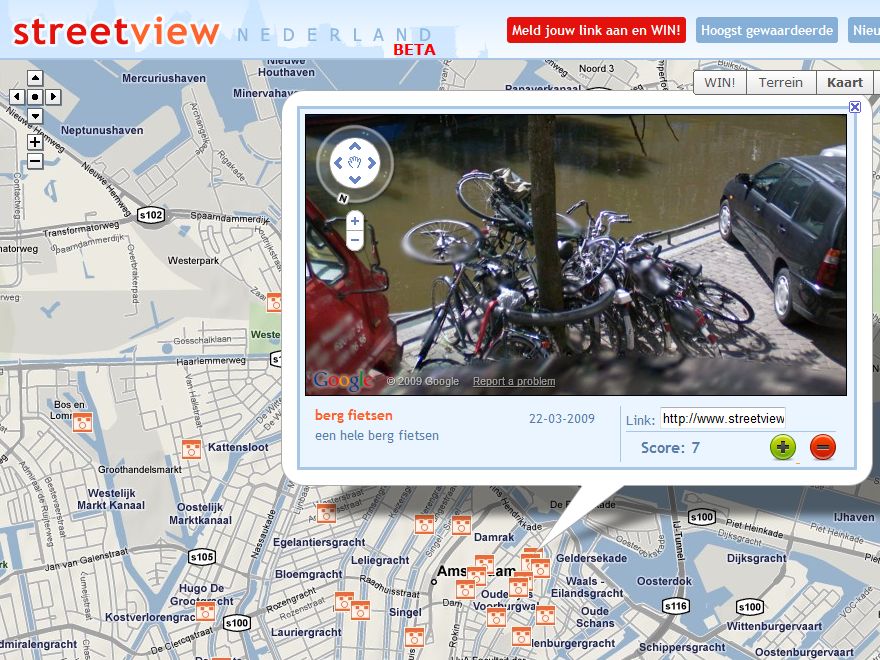 Google Street View arrived in the Netherlands last month, along with a creative application for Street View “sightings”, those funny and weird things caught by the Google car’s 360 camera. If you don’t want to spend all your time coming the streets for something hilarious, you can take a look at what other people have found at “Streetview Nederland”. So far just Amsterdam, Rotterdam and Groningen. Note: anything too salacious or incriminating seems to be quickly removed, and if you want your house “blurred”, Google will do that.
Update 30/6/2018: Dutch version not available, but other sites developed… such as this – Streetview World . Better yet, google “Streetview sightings“.
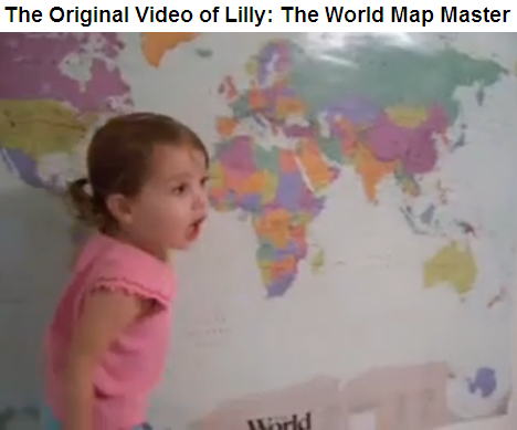 This-Two Year Old is a Better Geographer than You (was in the All Points Blog, now Directions Magazine) caught my attention, just too cute to pass up. The 2007 YouTube video was originally a response to the Miss Teen USA South Carolina answers a question. (See Sept 2007 post Sniggering). Apparently Lilly was later on Oprah, and Jay Leno. The video has been viewed over 4 million times. Maybe it would be nice if more parents played map games like this with their kids.
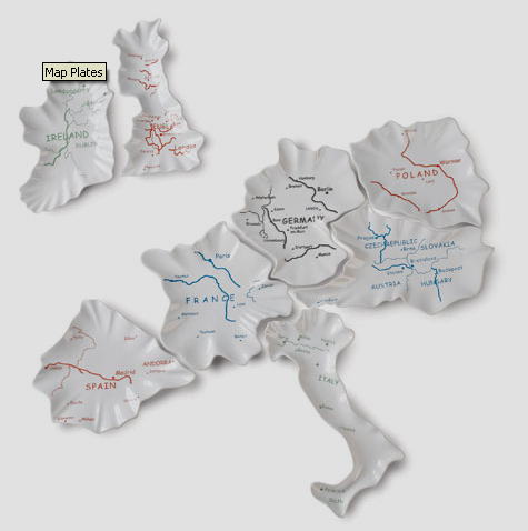 Or you could buy these plates and teach them that there are just eight countries in Europe. (The makers might have at least made a toothpick dish out the Netherlands.)
Update: 27/6/2018: Map plates don’t seem to be available any more, probably for good reason.
 Irresistable. View it on YouTube. But watch your back.
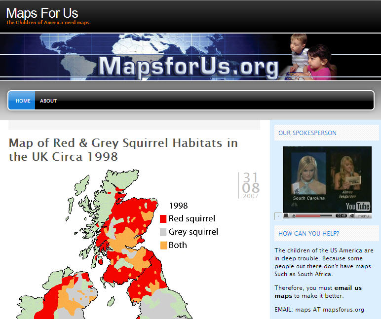 Cartography met pop culture a week ago when a candidate for Miss South Carolina answered a tough question about American school children’s geographic myopia. She was asked what the reason could be for the fact that 1/5th of Americans cannot locate the US on a world map. (That was the NOTfunny part of the story.) Her bizarre answer included the assertion that “Some… people out there in our nation don’t have maps.” Since then, more than 11 million people have viewed the YouTube video, making it the most viewed video for the past month, and in the top 50 for all time, even after just a week! Embarrassing as it was and is for us “U.S.-Americans”, it is also hilarious and provoked many delightful responses, especially the website MapsForUs.org, which continues the exploit the merriment (and has a link to the video). Did she win? Came in fourth.
Update: 27/6/2018: 67 million people have viewed the video. Miss South Carolina, Caitlin, had a rough time after the video went viral, but seems ok for now. The website MapsForUs.org, meanwhile, has not fared so well. Doesn’t exist.
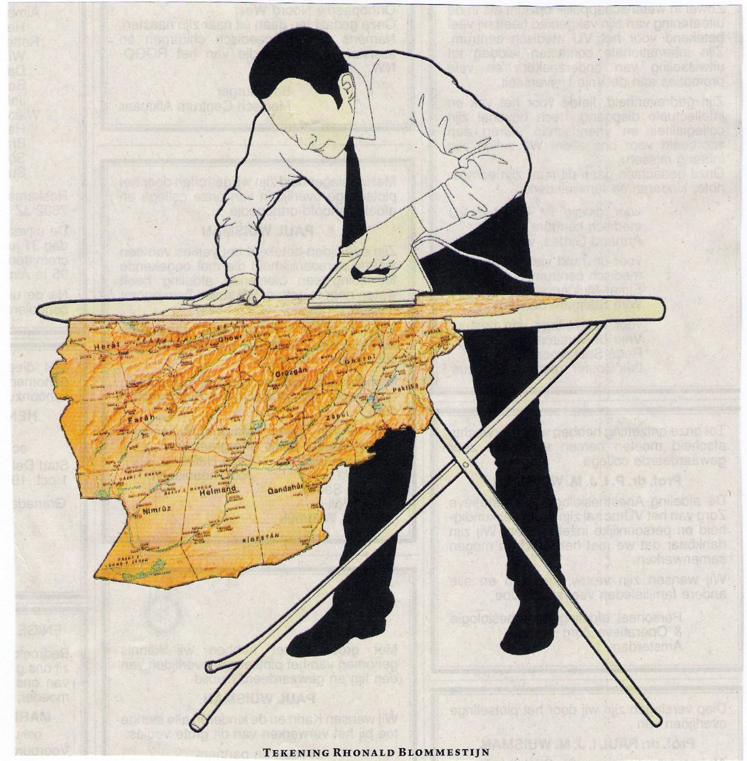 This illustration by Dutch artist Rhonald Blommestijn is a wonderfully ironic illustration of (Bush?) ironing the map of Afghanistan. On his own website, Blommestijn describes himself as: “illustrator of the un-illustratable”. His work is conceptual and philosophical, sometimes informed by Escher and Monty Python. This illustration is reproduced without permission, and it will be removed as soon as someone tells me I should remove it.