Map of Maps
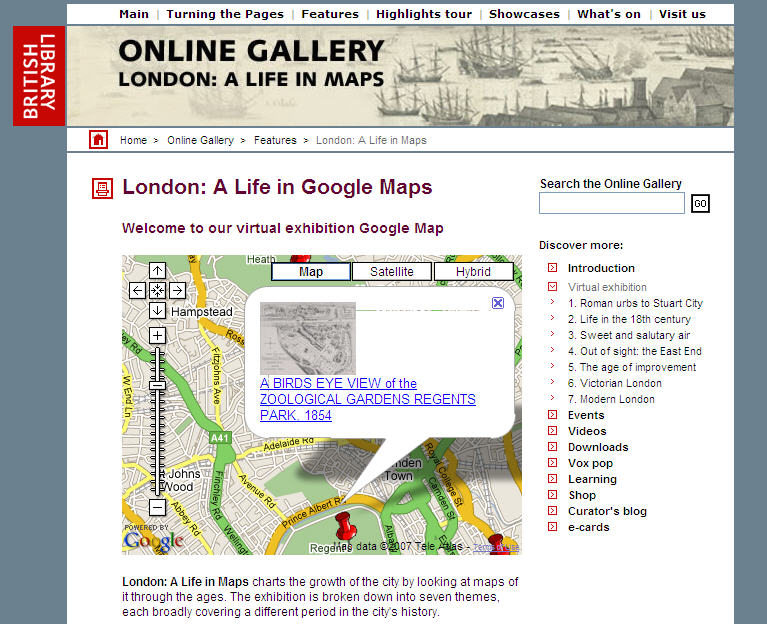 A post today on the interesting Free Geography Tools blog provides a summary of some of the great digitized historical map collections. For example, the British Library has a large scanned maps collection, and an oddly anachronistic feature: London: A Life in Maps featuring red google pushpins identifying the point of focus of various antique maps and prints of London.
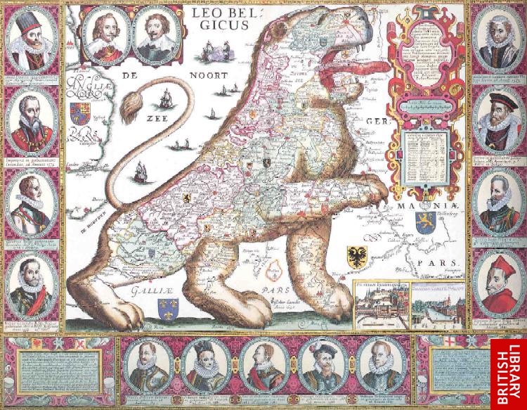 Another interesting British Library holding is the Christofel Beudecker collection of Dutch maps, purchased by the ritish Museum in 1861.
An example is this charming Leo Belgicus which reminds us that maps were fun even back then.
Leave a Reply
Want to join the discussion?Feel free to contribute!