Queensland Down Under
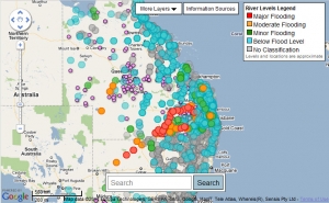
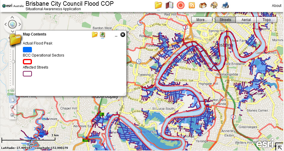
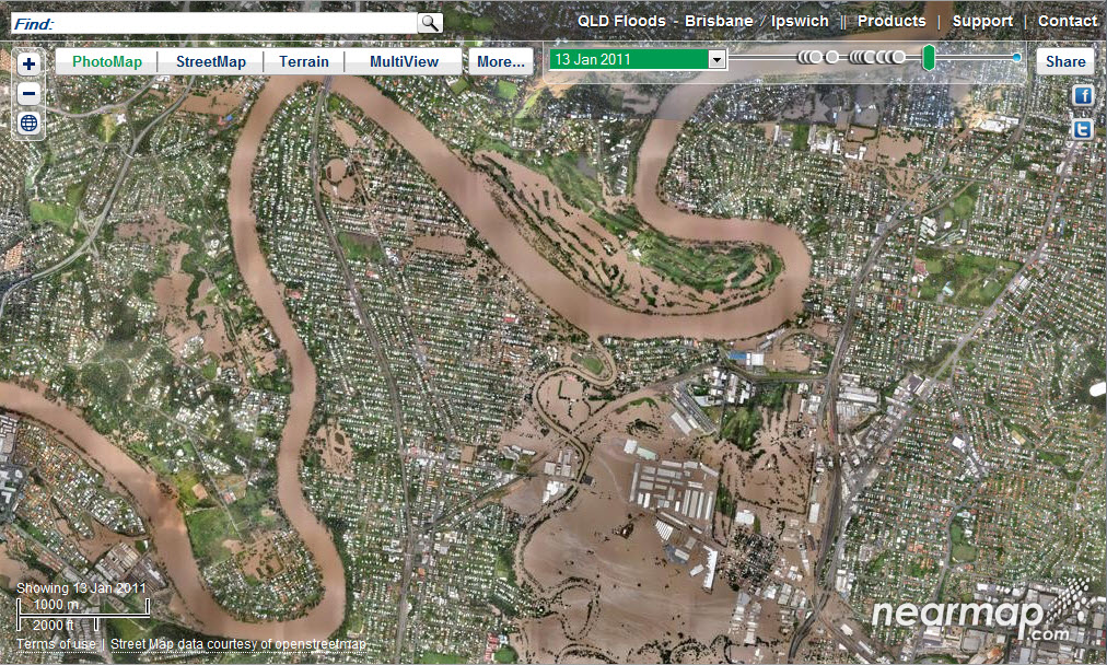 We watch helplessly as Queensland went down under this week, and then gradually resurfaced wallowing in mud with at least 18 lost lives and billions in damages. Examples of disaster maps produced in response to the crisis include: 1) Before and after photos by Nearmap.com, an Australian company offering areal photography services showing change over time in an Open Street Map environment. 2) Google’s crisis response map. 3) The Brisbane City Council situational awareness map created by ESRI Australia using ArcGIS and Bing Maps.