Oil spill maps
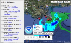
 Three ways to view the spill’s progress: 1) Google Crisis center, with map data from NOAA and PBS live news feed showing the gushing oil, and 2) Paul Rademakers Google Earth representation of the (no longer works), showing how it compares in size to Manhattan, London, Paris, etc, 3) New York Times”Tracking the Oil Spill in the Gulf“,map updated daily.
Update 3/9/2018: The Times site is still available. Wikipedia’s report is a good way to look back at the crisis and aftermath.
