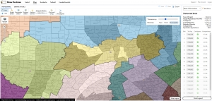
Gerrymandering – the Line Dance
 The 2020 U.S. Census controversy brings attention to many mapping issues, most importantly the recent U.S. Supreme Court ruling on Partisan Gerrymandering. GIS Software is sometimes viewed as the guardian angel, abut more often the devil in the bizarre American governmental process of “redistricting”. This occurs on a state-by-state basis after the completion of the census, which is held every 10 years, with the purpose of readjusting voting districts to take into account changes in population and demographics. The idea is to improve representation, but the process has become deeply politicized. This is a good, simplified explanation: The Line Dance, by Chris Satullo, director of the Draw the Lines Project. Along with the website providing a wealth of information, links and instructions for Pennsylvania’s version of DistrictBuilder open source map application, designed by Azavea, encourages the public to understand the redistricting process and submit their own maps which reflect their wishes. Here is an excellent video tutorial.
