MS Researach with GIS
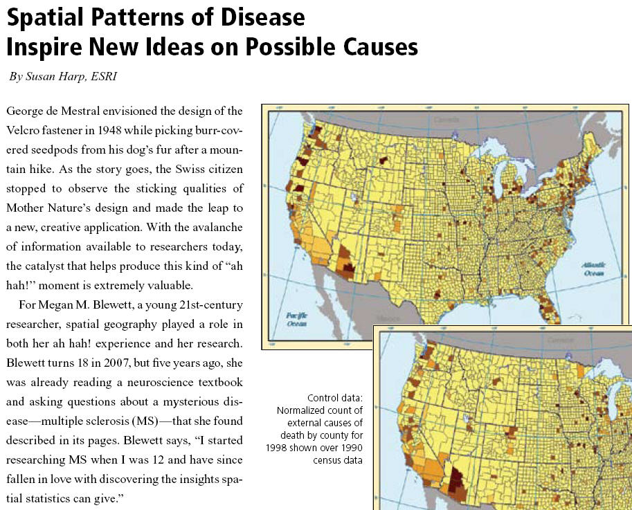 The spring edition of “Healthy GIS“, ESRI’s newsletter for GIS users in healthcare fields, features a fascinating article about a young (18 years old) researcher who is investigating the causes of MS, using GIS software. Correlating data on the incidence of Multiple Sclerosis by US county with the incidence of Lyme disease, Megen Blewett, has developed a hypothesis about a possible cause for MS: secondary tick bites. Whether or not this hypothesis is scientifically and bio-medically validated (apparently scientists are now looking into this), the article illustrates a fascinating approach to medical research which is probably greatly underutilized. As young Megan herself explained, the greatest difficulty was finding the data. She claims to now have (to her knowledge) ”the largest standardized data set of Lyme information.” She wants to expand her research globally. Her website is: www.msgeographics.com (no longer exists). Note, this is a case where GIS software (such is ESRI ArcGIS) must be used for spatial statistics, but it is fantastic to think about Google Maps / Earth becoming tools for sharing the results.
Update 31/5/2018: Where is she now? Starting a promising career it seems. Megan Blewett.
Leave a Reply
Want to join the discussion?Feel free to contribute!