Geography of Buzz
 An article in the New York Times today discusses the use of a GIS spatial analysis technique referred to as ”cluster analysis” for an unusual application. Researchers Elizabeth Currid of USC and Sarah Williams of Columbia University’s Spatial Information Design Lab presented their conclusions at a meeting of the Association of American Geographers recently. The researchers geocoded 300,000 photos and 6000 events from the Getty Imges database. With this data set, the Global Moran’s I statistic was used to find hotspots in New York and LA. The conclusions may not be so very surprising, but the use of photo media is interesting. This type of social research is likely to show up more often as people begin to mine data from geocoded images (e.g. Picasaweb and Flickr) or geotagged Tweets.
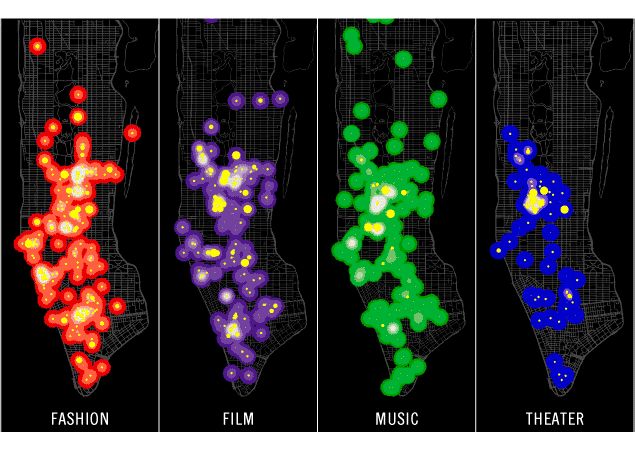
The study was partly inspired the work of Richard Florida who developed the concept of the “creative class” and created a stir with Amsterdam planners at a 2003 conference titled “Creativity and the City”.
Update 30/6/2018: No doubt a lot more research in this area to be found. For example Trendsmap